
Good evening everyone,
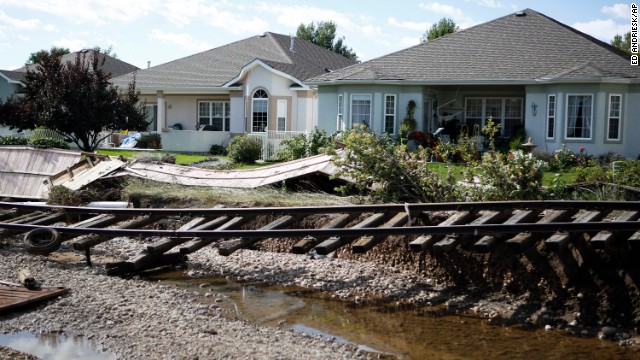
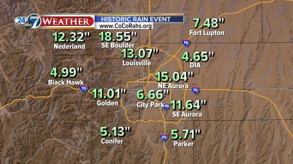
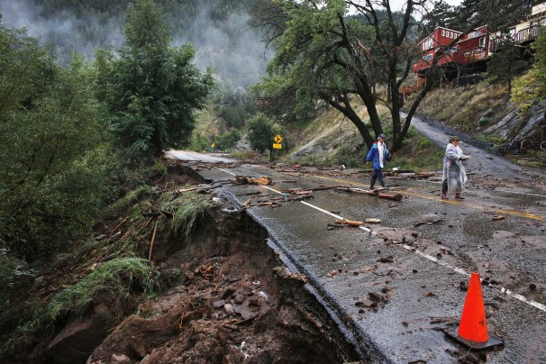
I was watching Monday Night Football tonight in Colorado and I couldn’t help but think about the terrible flooding that state has experienced. Lives have been lost, more people are missing, and roads, homes, and businesses have been left in ruin. The numbers are staggering: 17 to 18 inches of rain in many areas in just a couple weeks. That is more rain than Superstorm Sandy delivered to any area and more than three times the typical monthly total for September…and the month isn’t even over.
But there was no hurricane over the Rockies and the region does not see monsoonal rain like Arizona. The reason for the endless rains was far more mundane: the rain was caused by a cut-off low (as in low pressure system). A cut-off low is a counter-clockwise spinning area of low pressure, high up in the troposphere, that has become separated from the jet stream. Without the jet stream to push it along, a cut-off low (or high) can sit over the same region for days or weeks, bring persistent sun, clouds, or rain.
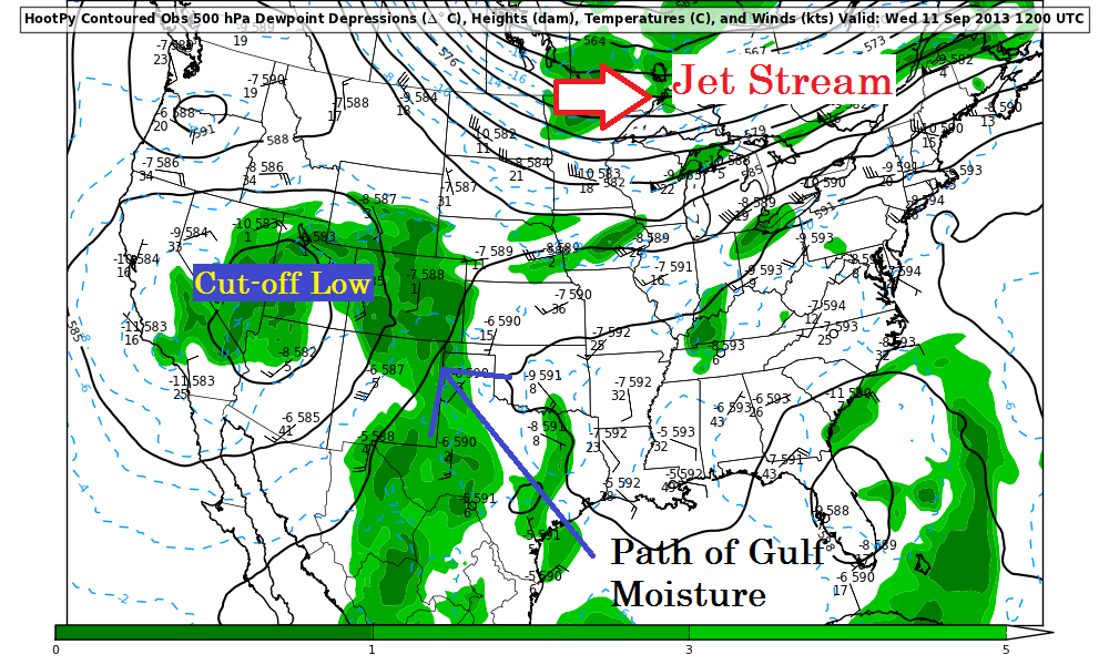
Spinning counter-clockwise, the large system started to bring in Gulf moisture, and plenty of it. The Gulf waters are still very warm and the air is quite saturated. You know had one of the two ingredients needed for rain: moisture. The other, rising air, will be provided by Colorado’s terrain. The moisture-laden air will have as-of-yet traveled over pretty flat terrain. The air is humid and some rain does fall, but most of the moisture is retained. But it hit Colorado the terrain rose and the air must to the same. With the air above moist and rising, rain started to fall…and fall…and fall. The low created a conveyor belt which continued through the first half of this month.
A cut-off low is hard to predict, models have difficulty predicting when these conditions will initiate and even more difficulty predicting when they will break down. Situations like these gives meteorologists a truly hopeless feeling; something terrible is happening and you don’t know when it will end. Thankfully the pattern changed recovery has begun in Colorado, a new flood of aid and support has rushed in and life can begin to return to normal. But those in Moore, OK and Staten Island, NY can tell you that the process is slow and help is still needed long after the story leaves the airways. I encourage all of you to donate to the Red Cross and help in the relief efforts.
Have a good night everyone and thanks for reading. If you haven’t yet please follow Wildcard Weather on Twitter by clicking the blue button at the top of the page.
~Wildcard

Great write up. Thanks. If you want your donations to go directly to Colorado, go to http://www.HelpColoradoNow.org. The Red Cross link at that site (and many other organizations) will keep all funds donated in Colorado. They need your help!